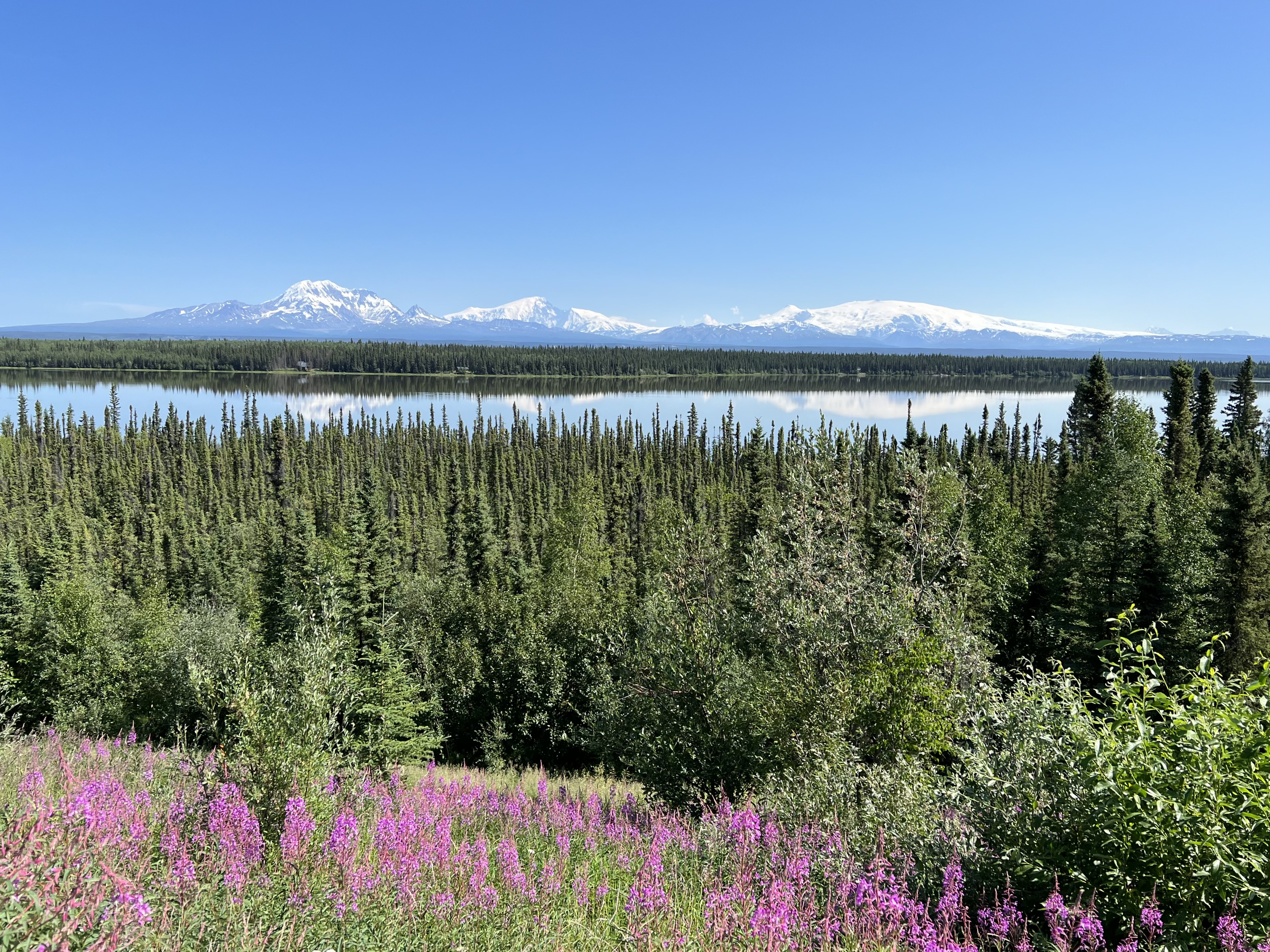
Wrangell St. Elias National Park from afar. Left to right, Mt. Sanford, Mt. Drum, Mt. Wrangell.
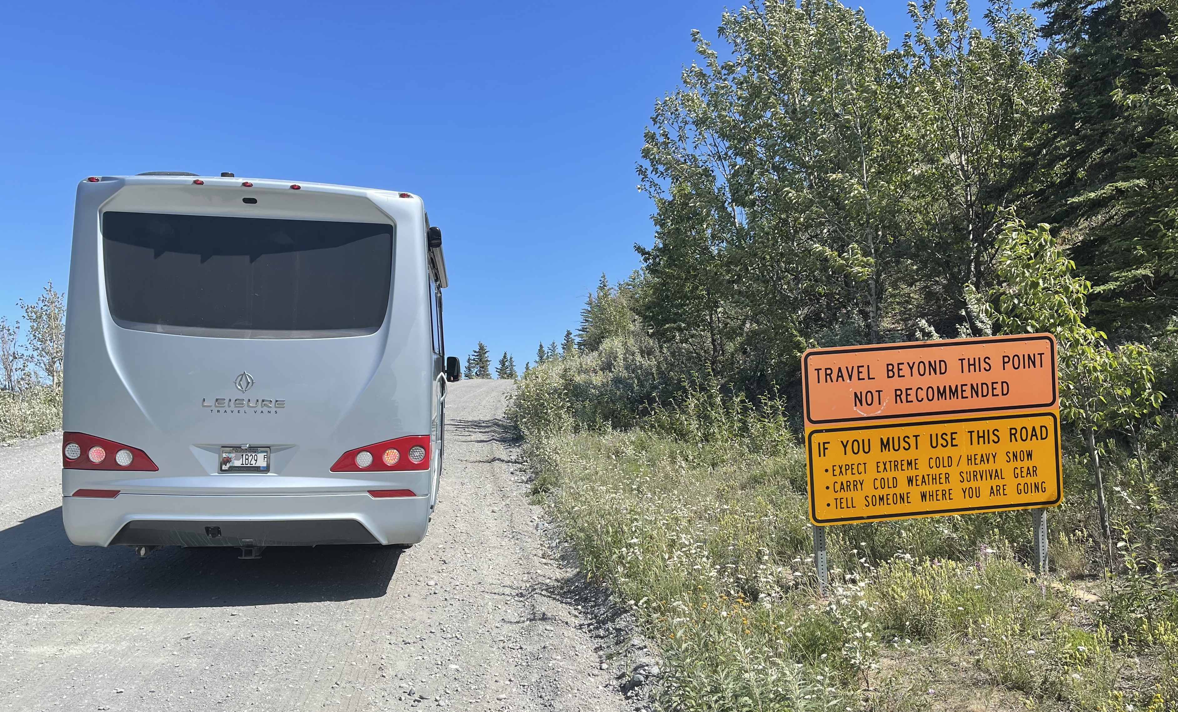
Entry to Wrangell St. Elias. Sixty-four dirt-road miles to go.
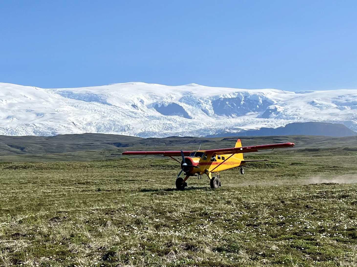
Two faint skid marks and a tattered yard of neon-pink plastic were all that differentiated the airstrip from the vast gray-green tundra of the Wrangell Plateau. How our pilots spotted them from a couple hundred feet in the air, I have no idea. Our first plane, a waspish, yellow and red, 4-seater Cessna 185 came in low and landed smoothly, rolling to a stop on the uphill track. The Cessna turned quickly, taxied onto a shoulder and parked. Our second plane, a slightly larger, 5-seater de Havilland Beaver swooped down in a low arc and headed toward the airstrip. Bill, the pilot, warned us to brace for a bump. “This old plane is reliable,” he said, “but it isn’t smooth.” It took three good bounces on balloon tires before we settled to the ground and stopped. John and Jed jumped from the Cessna. Bob, Robin, our guide, Peyton, and I emerged from the Beaver. Within five minutes, all our gear and provisions were in a pile. The pilots waved, called “Bye, see you in four days,” and took off. We were on our own in an immense, pristine, wilderness.
The Beaver bounces onto the airstrip.
I looked up and surveyed our surroundings. We were on a broad, undulating plain that stretched for miles and miles in every direction. We could see forever. There was not a tree or shrub more than two feet tall to obstruct our view. The tundra, which at first glanced seemed a dull, dusky monochromatic green, was alight with small, bright wildflowers. White and yellow wind flowers, bright pink moss campion, yellow potentilla, low purple lupine, and bright orange fire weed all popped from the gray reindeer lichen and sage-colored tundra.
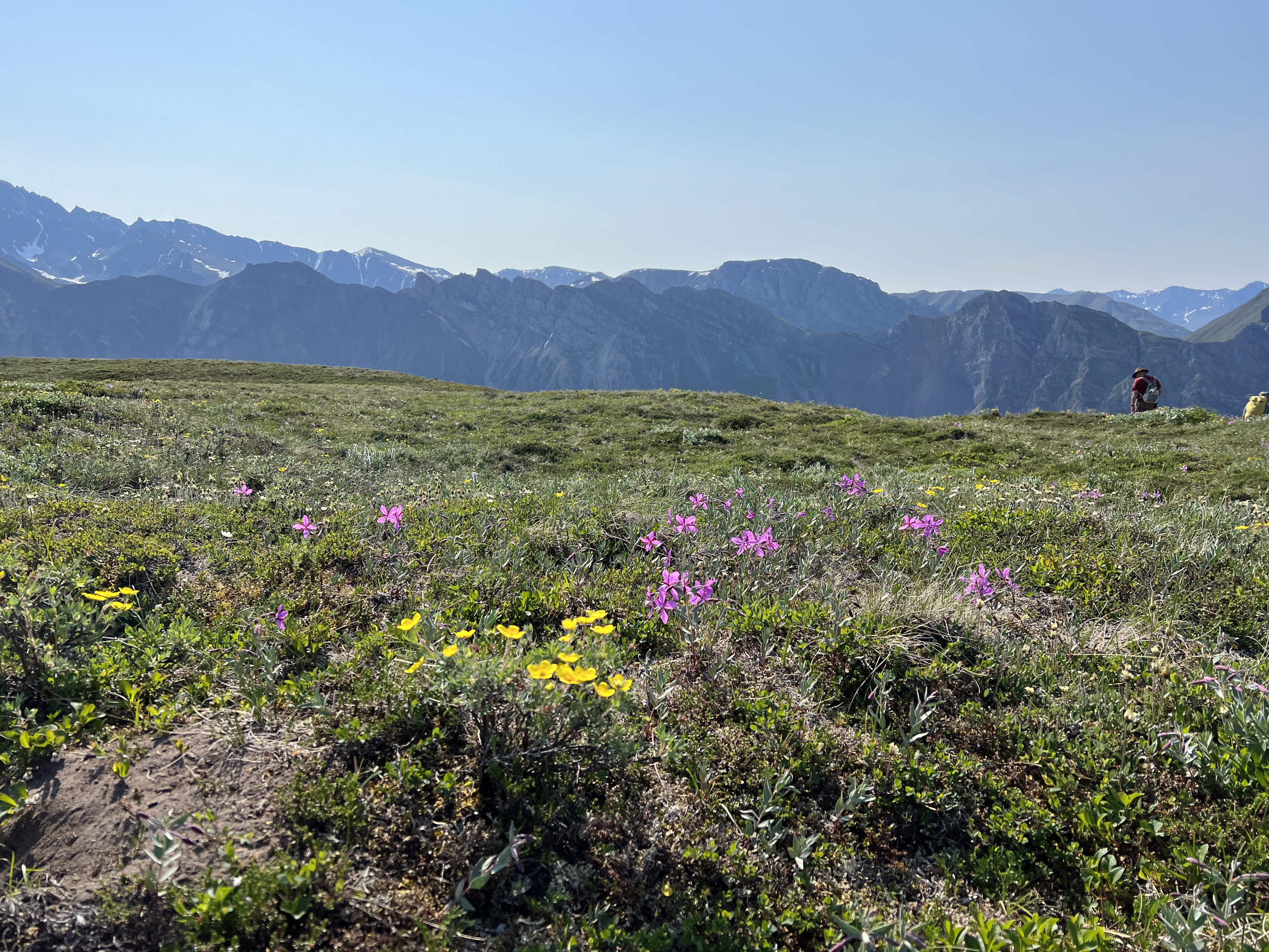
Wildflowers were everywhere.
Directly in front of us, occupying about 120 degrees of the horizon, loomed an enormous, white, leviathan — Wrangell Mountain. It literally took my breath away. “Holy s*#@t!” I thought. That is enormous, all encompassing, magnificent! I had a flash of understanding why native people might pray to such a mountain. “Hey Anne,” Bob called from nearby as he stared wide-eyed at the scene in front of us. “Does this remind you of anything?”
“Nope,” I said. I’d seen a lot of mountains, but nothing like this.
Mount Wrangell is a colossal shield volcano that, unlike its monolith neighbors, extends horizontally across the horizon. At 14,163 feet, it towered 9,500 feet above us. Wrangell has the mass of five Mt. Rainiers. A half-dozen world class glaciers cascade from its slopes. The ice field at its top – contained by Wrangell and its neighbors Mt. Sanford at 16,237 feet, and Mt. Blackburn at 16,390 feet — is as big as the state of Rhode Island.
We were awestruck. There wasn’t much to say. We just stared. Then we hefted our bags and walked the half mile to our camp site, a random spot on the tundra just above a small seasonal lake.
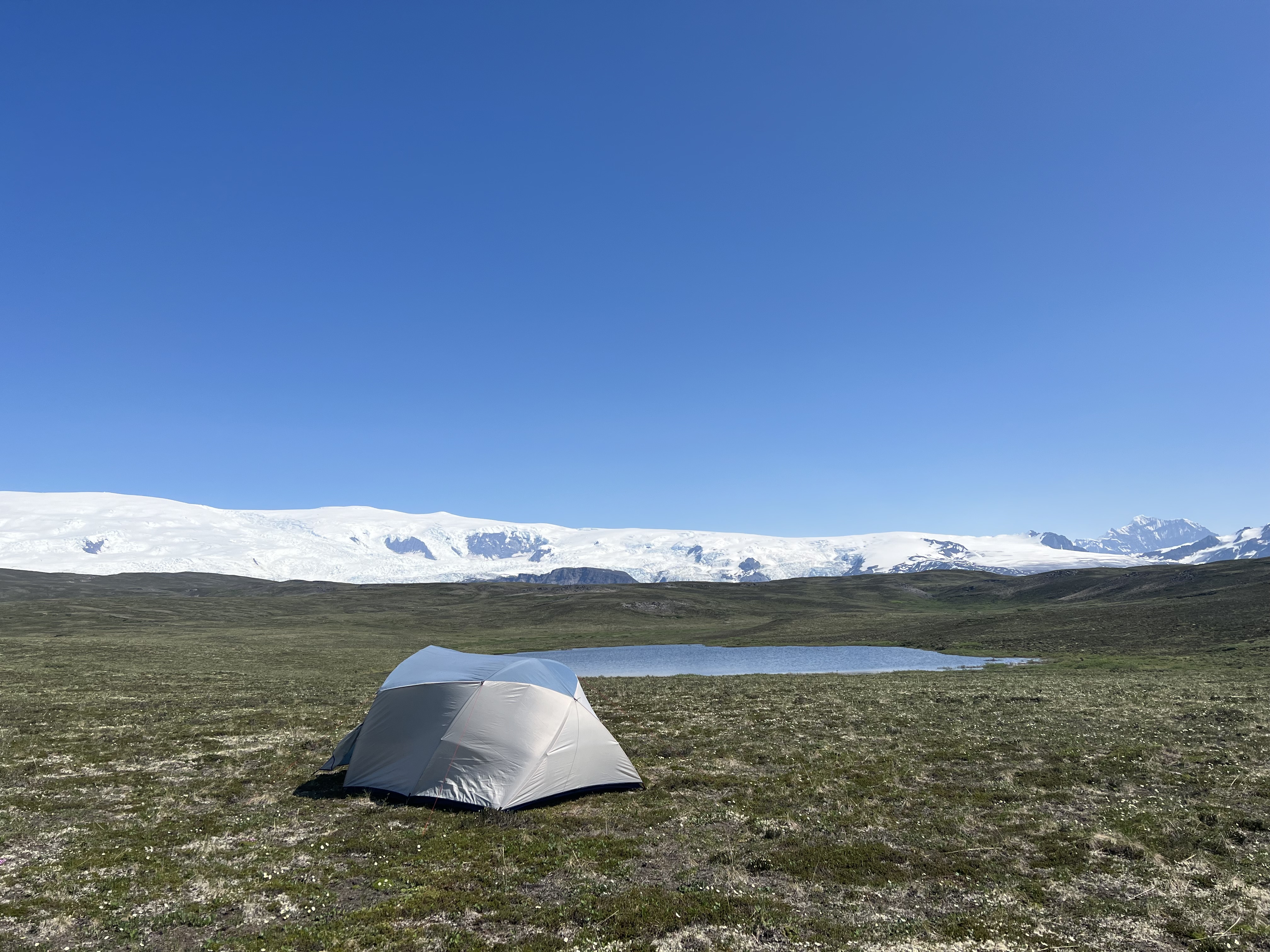
Our camping spot on the Wrangell Plateau.
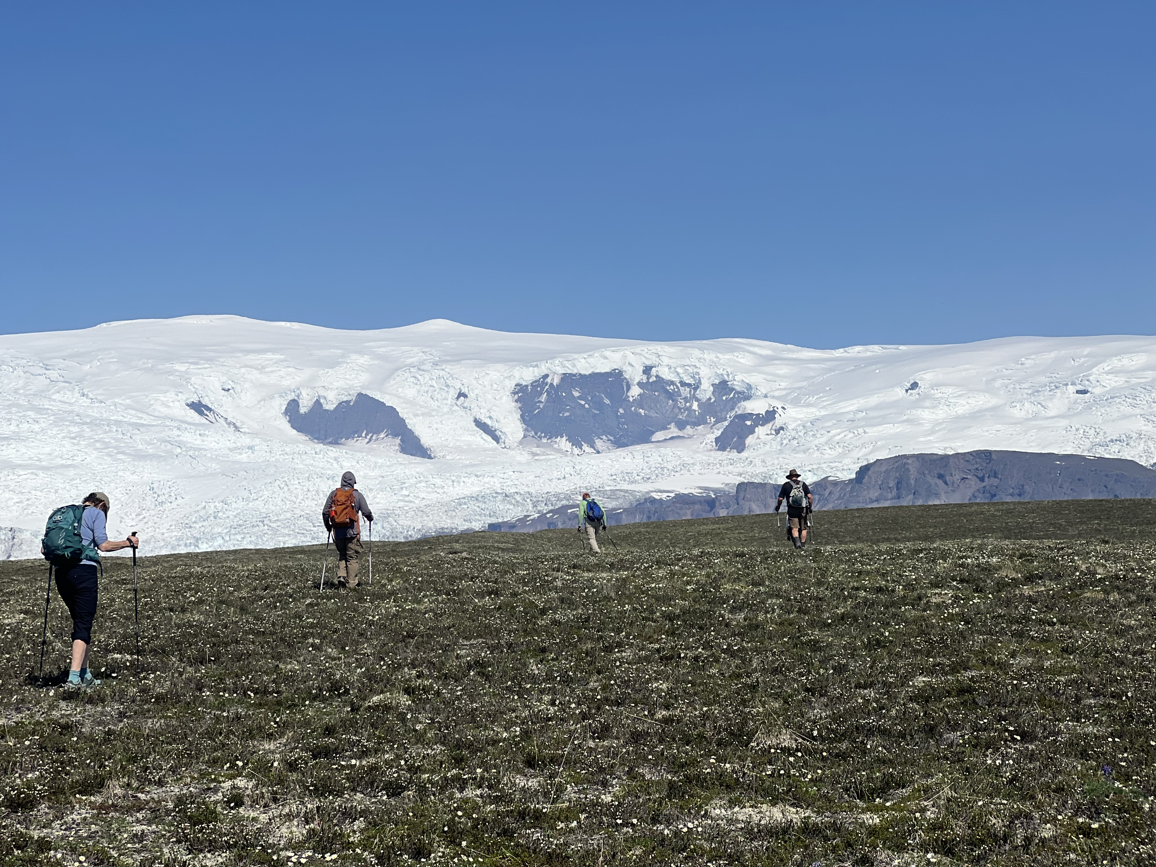
Wrangell Mountain is hard to photograph. It is so big, the plateau so devoid of contrast, the distances so vast that scale is almost impossible to convey. To get the whole mountain in a picture, you have to widen the focal range so far that the mountain becomes a white strip between the green earth and the blue sky. So, as you view these photos, try to remember that everything is 10 times bigger than it looks. We were miniscule dots on an immense landscape devoid of human tampering.
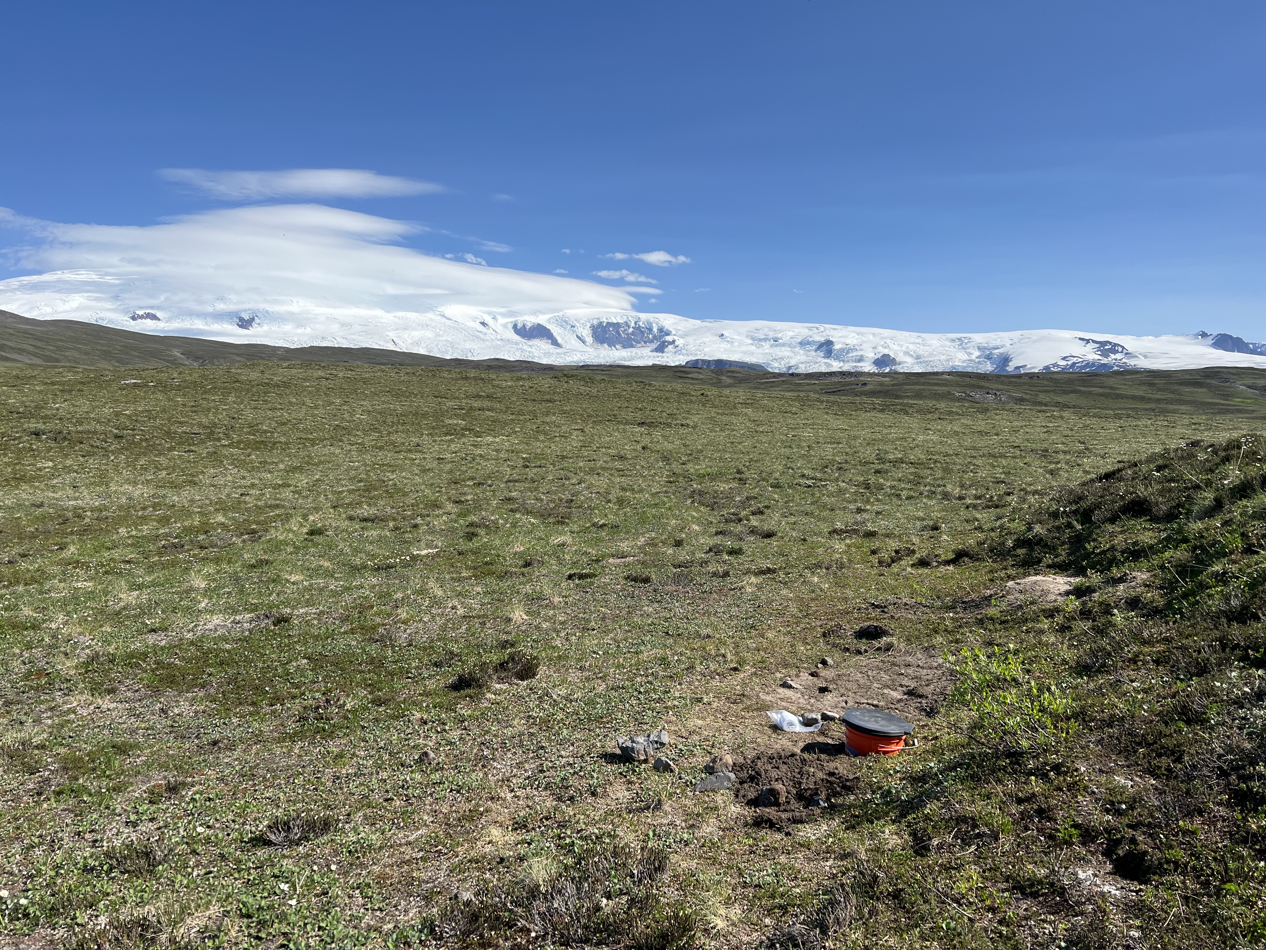
A loo with a view. The mundane with the magnificent.
We spent four days alone on the Wrangell Plateau. The first day we hiked four miles east to the cliff that marked the boundary between the tundra and Long Glacier. We walked along the ridge for a while under a blazing sun, marveled at the glacier, had lunch, hiked back to camp, and then jumped in the lake to cool off. The next day we hiked four miles north, up a steep slope, passing six Dahl Sheep to again reach the cliff that marked the boundary between the tundra and Long Glacier. We walked along the ridge for a while under a blazing sun, marveled at the glacier, had lunch, hiked back to camp, and then jumped in the lake to cool off. The third day we hiked four miles west to the cliff… you get the picture. Actually, the third day was a bit different. The destination cliff marked the boundary between the tundra, a different glacier, and a spectacular waterfall. We also saw a couple of caribou on the hike back to camp.
Hiking up the tundra toward the ridge. It was steep!
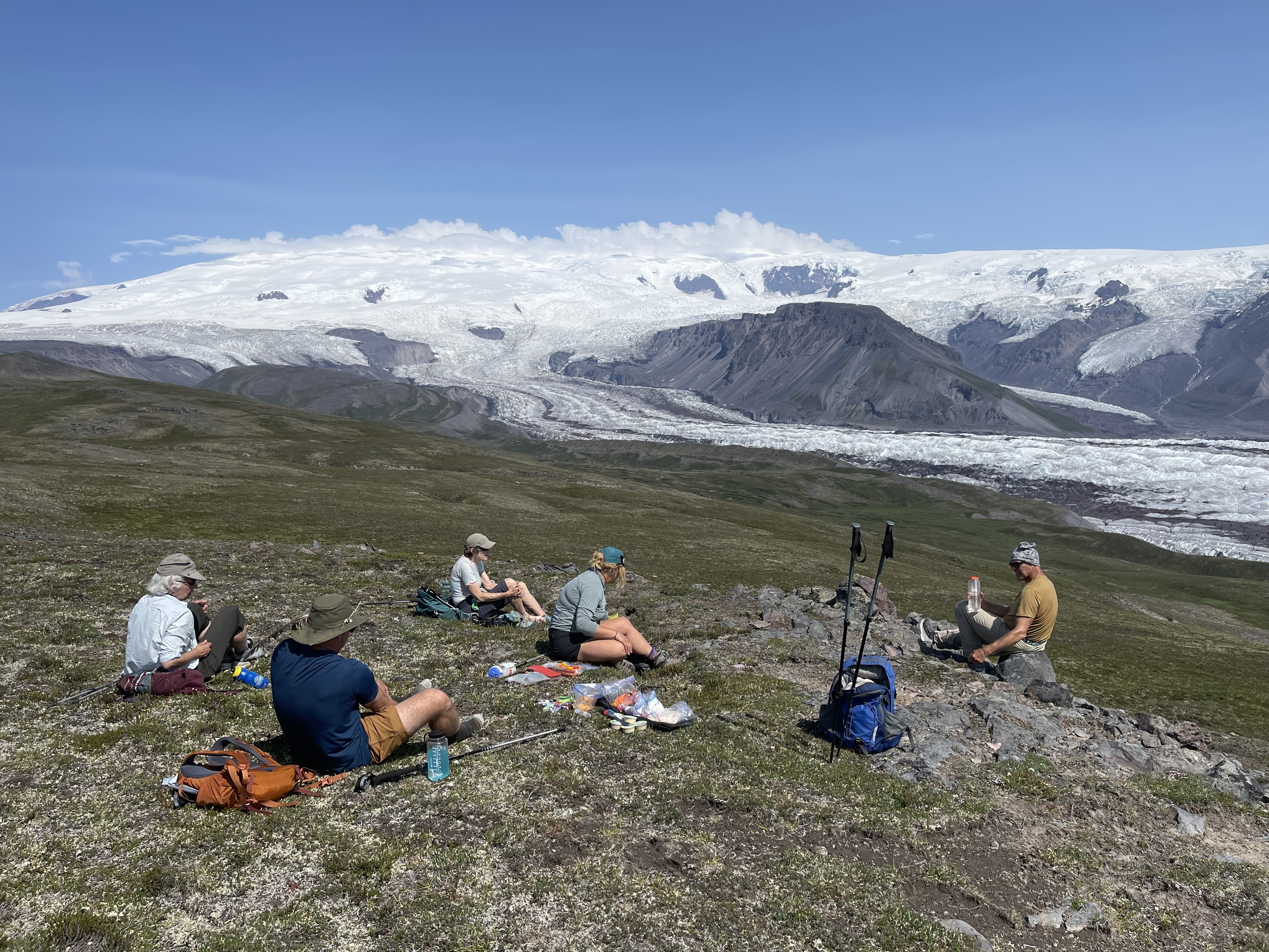
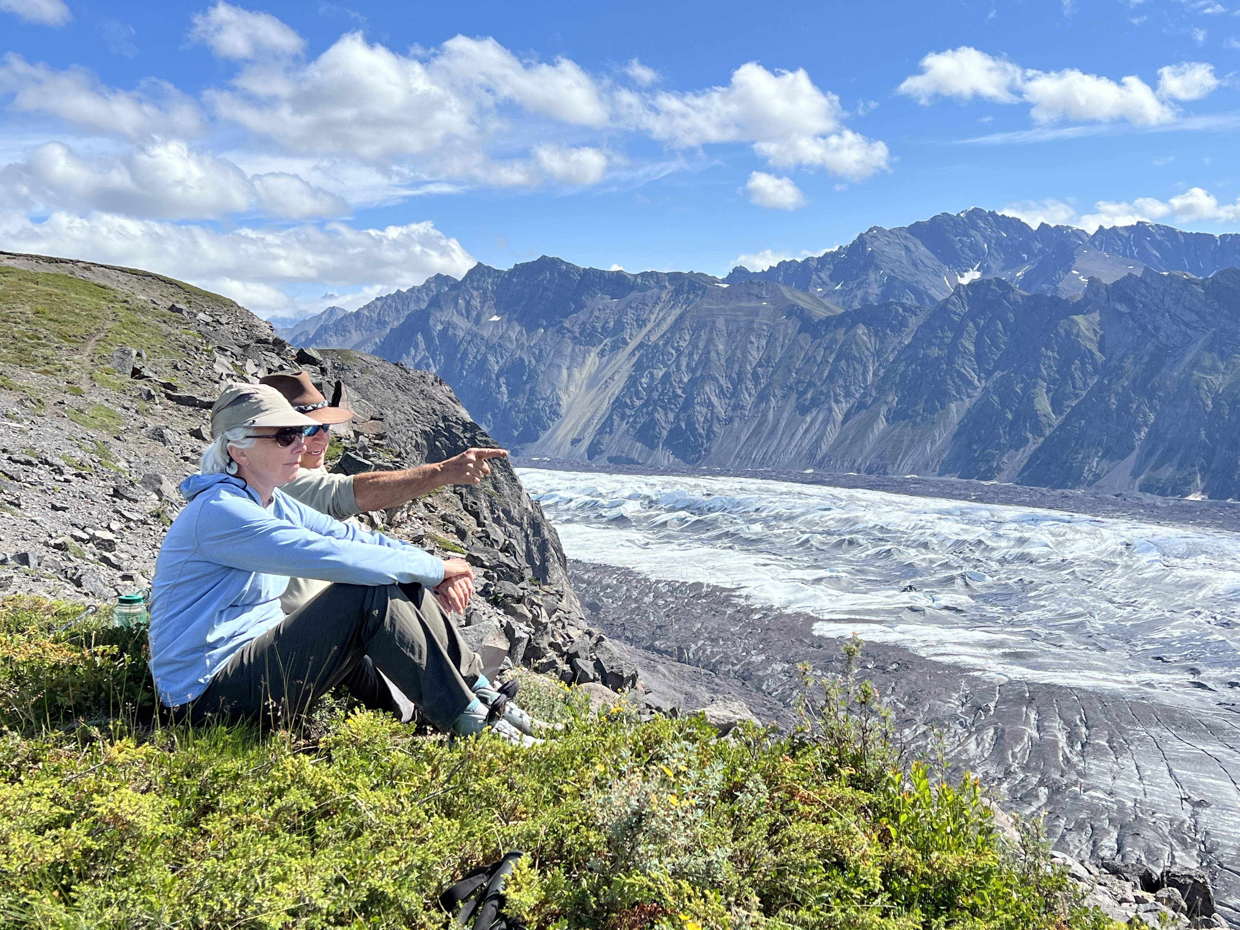
Lunch time overlooking the Long Glacier. It’s hard to visually comprehend that the Wrangell summit is 9,500 feet above us.
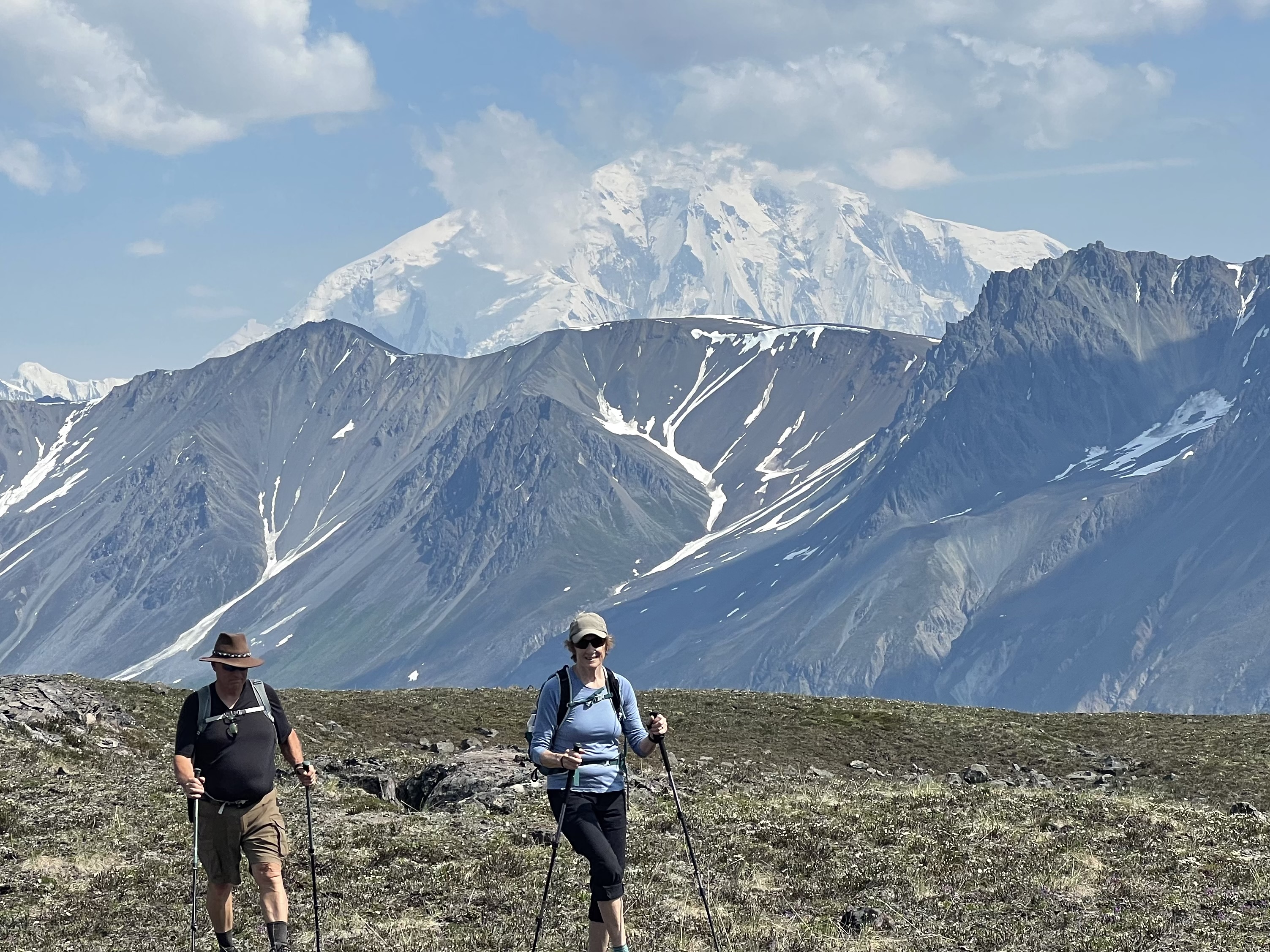
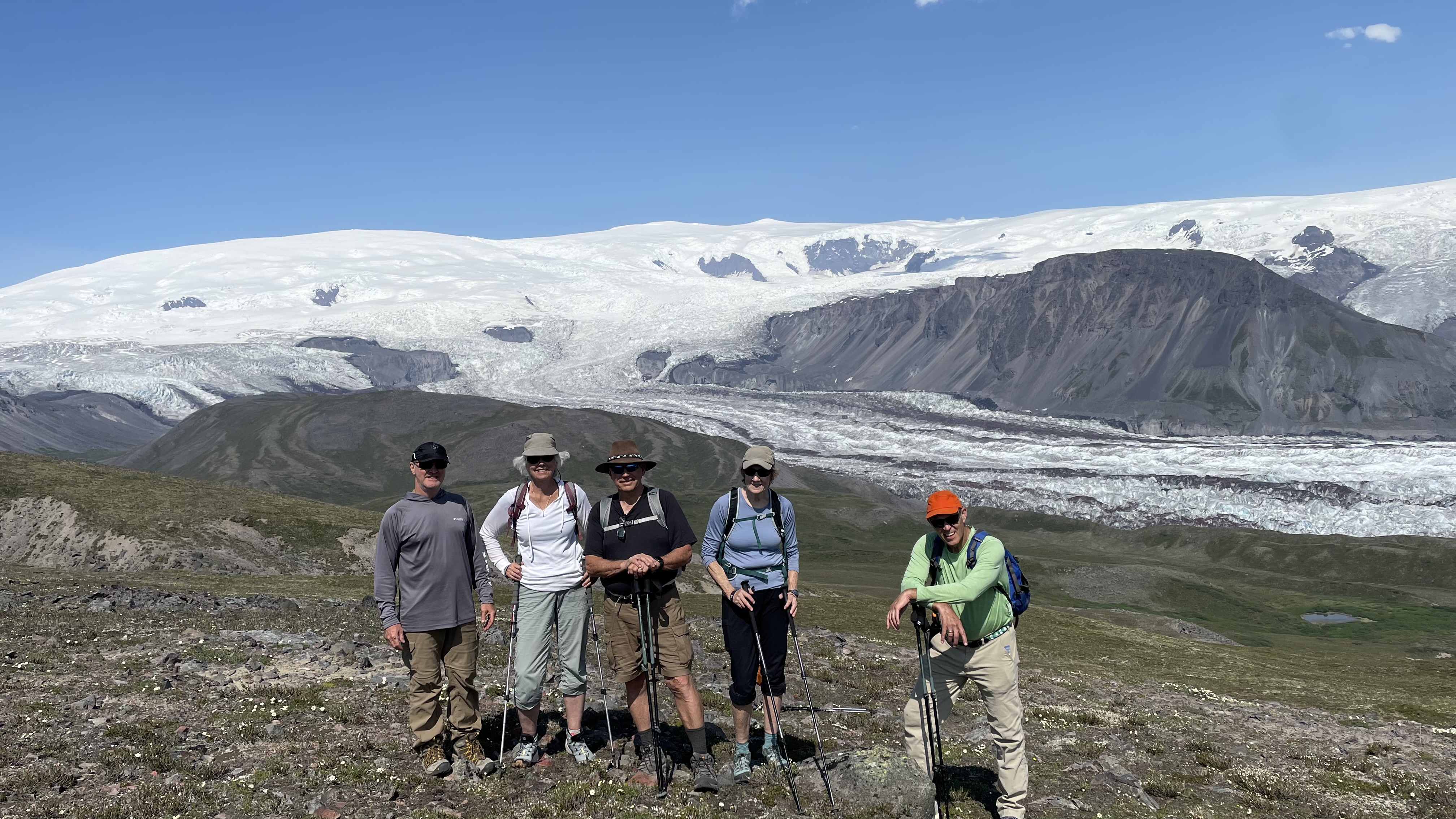
John and Robin with Mt. Blackburn in the distance.
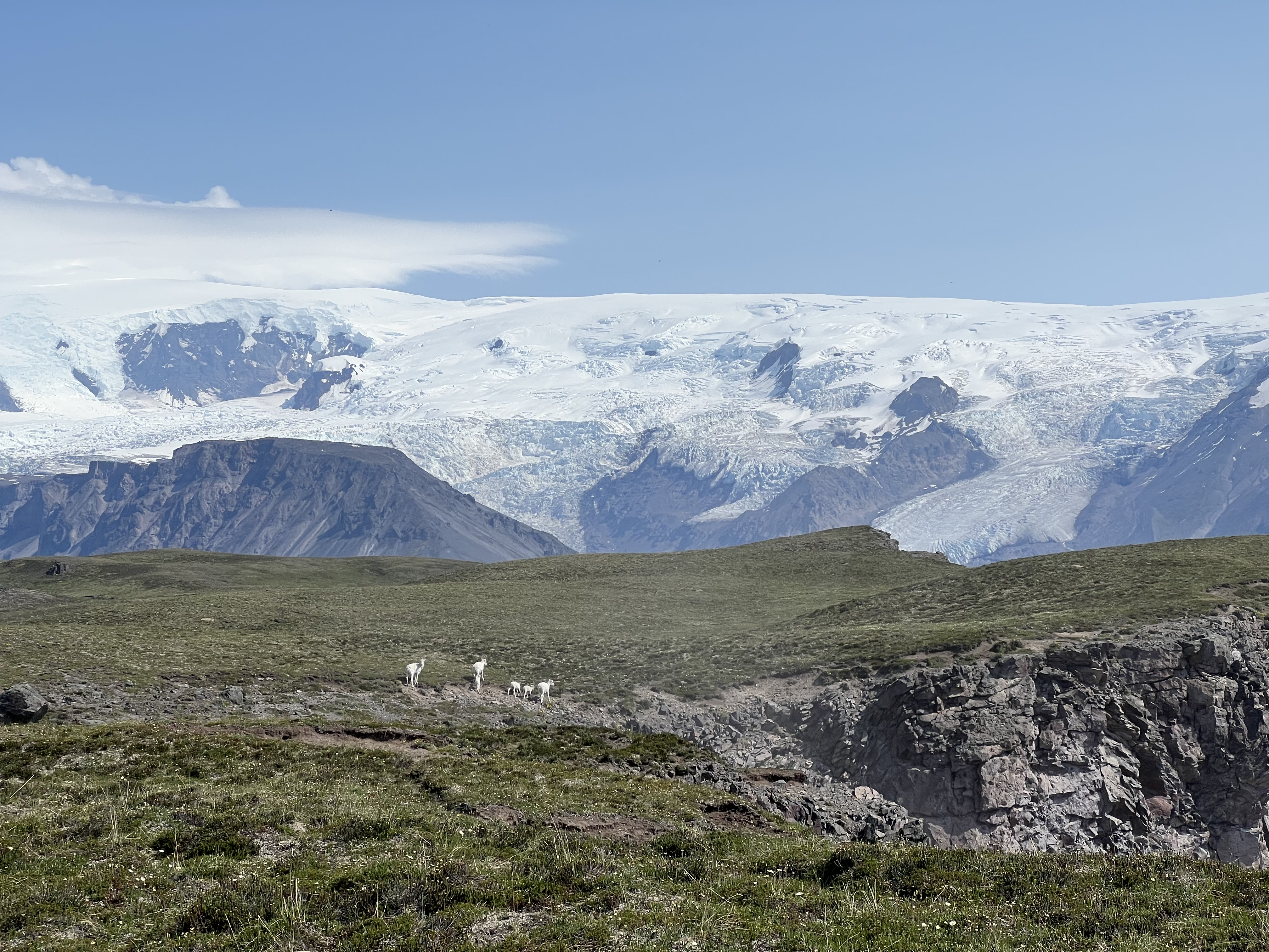
A family of Dahl sheep emerge from the cliff and hustle along the ridge.
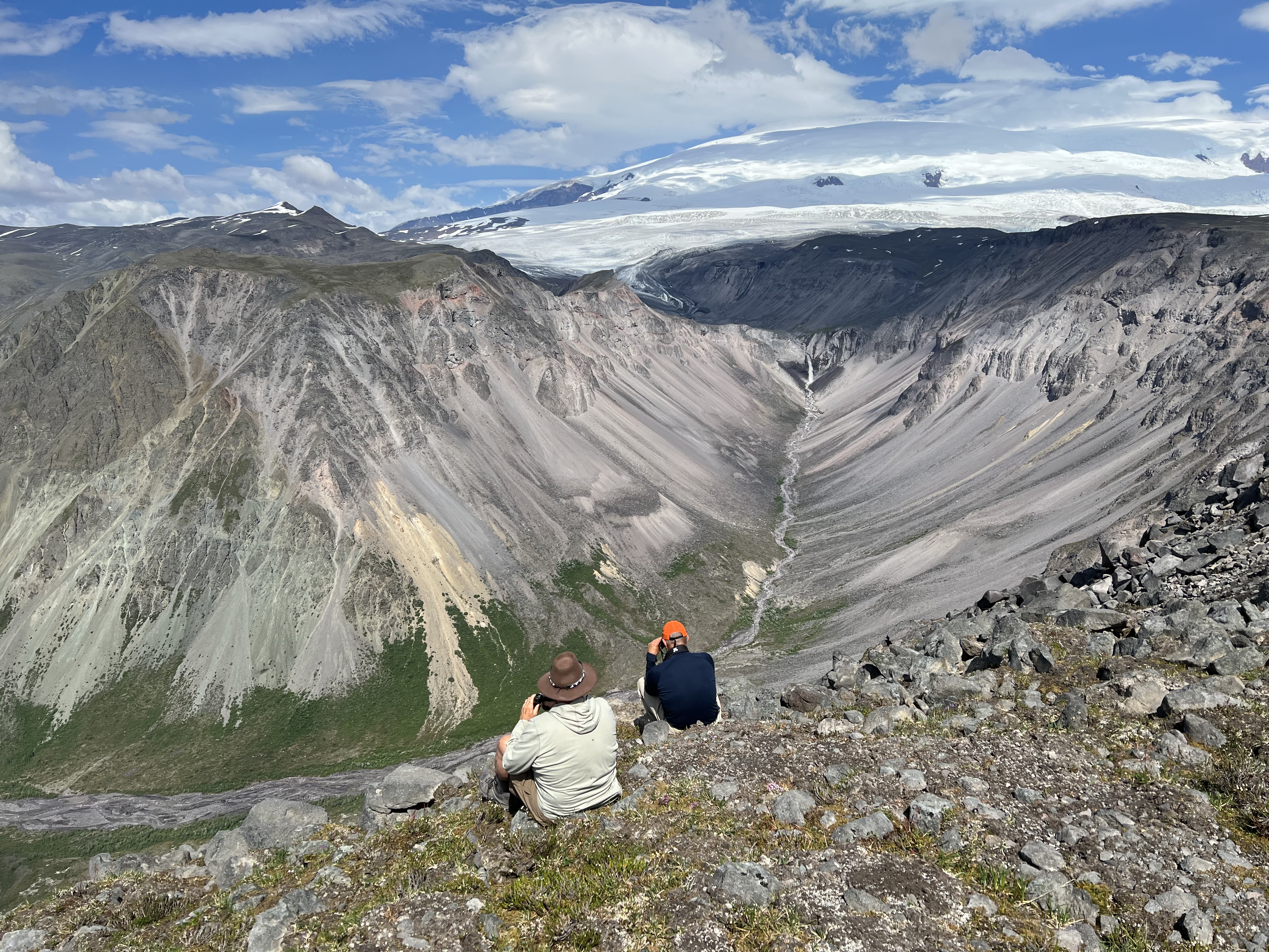
Day 3, a new glacier and waterfall. The camera angle.
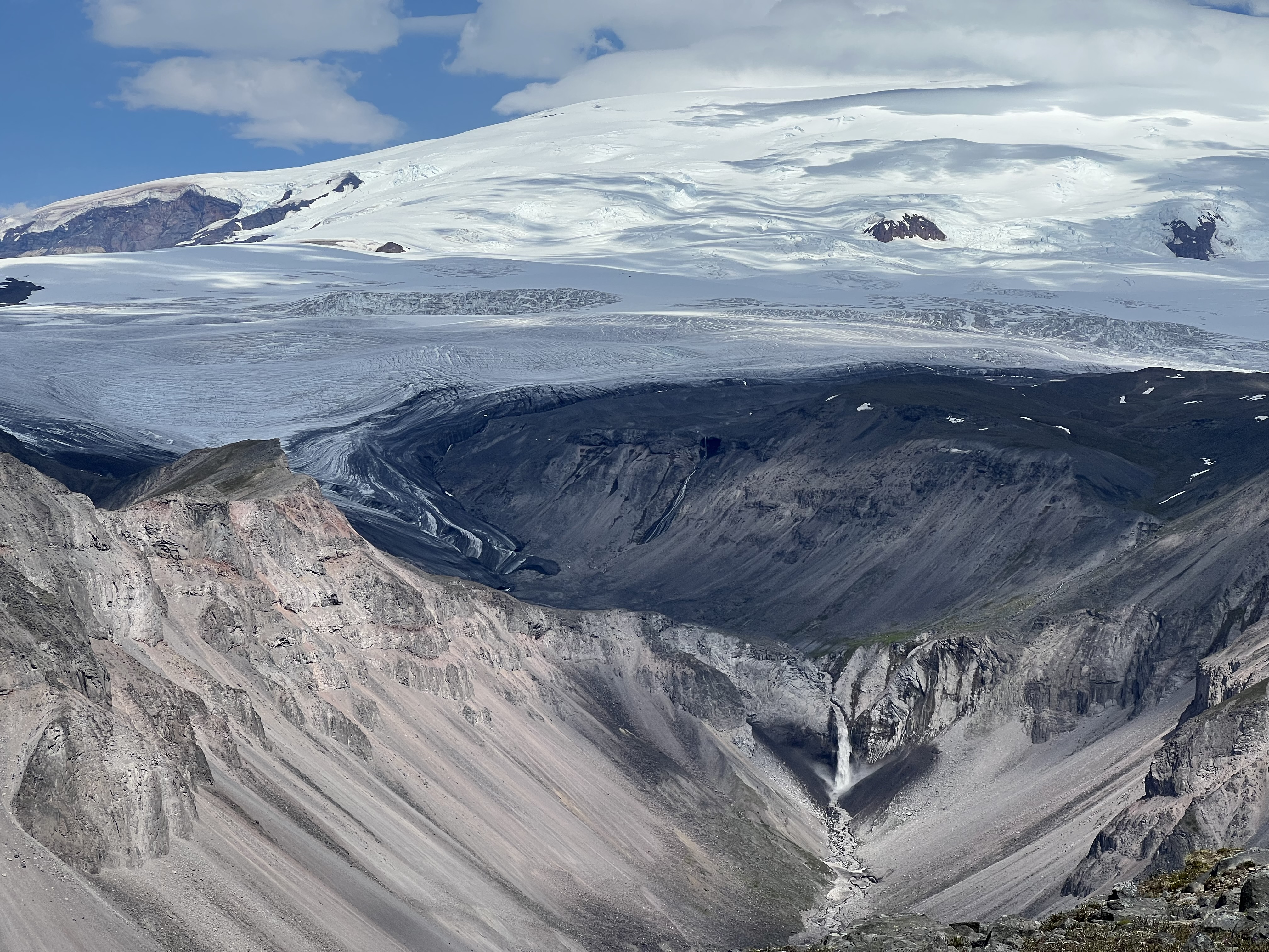
The human angle of the glacier and waterfall. The waterfall was hundreds of feet tall.
By the fourth day we were ready to pack up. Our good weather and warm temperatures were being replaced by wind, clouds, and a hint of frost at night. Wrangell was the perfect capstone to end my journey to visit all eight of Alaska’s National Parks. It reminded us of nature’s magnificence and our, ultimate, insignificance. Our visits to Denali, Gates of the Arctic, Lake Clark, Katmai, the Kenai Fjords, Kobuk Valley, Glacier Bay and Wrangell St. Elias were humbling and life affirming experiences.
Mt. Wrangell and the Long Glacier, our constant companions.
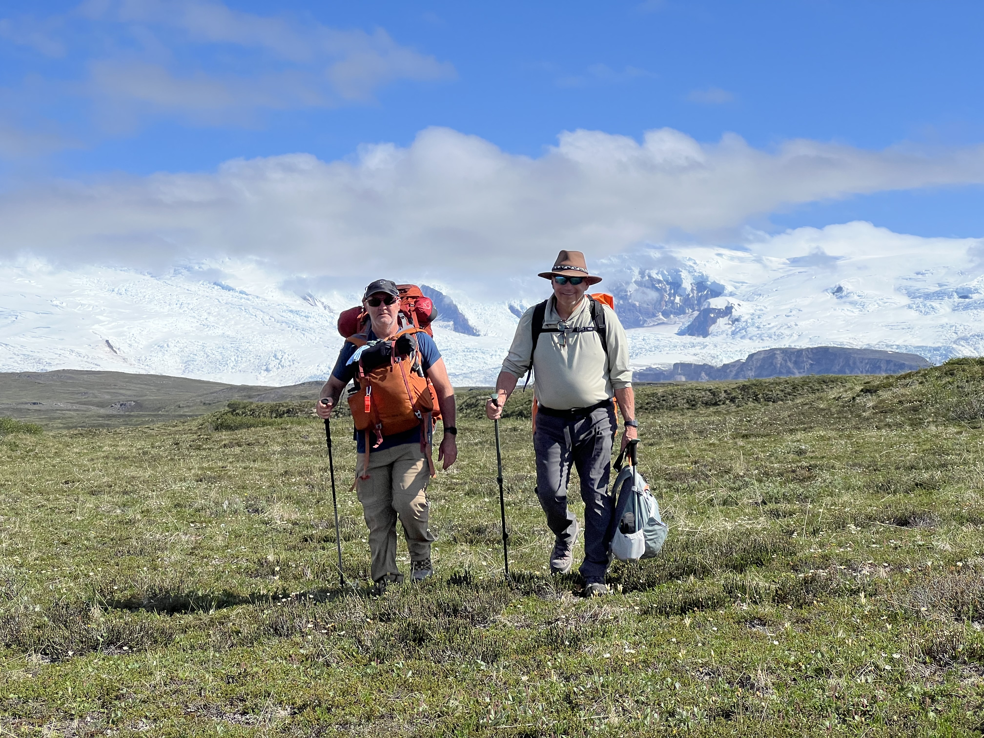
John and Bob hiking back to the airfield.
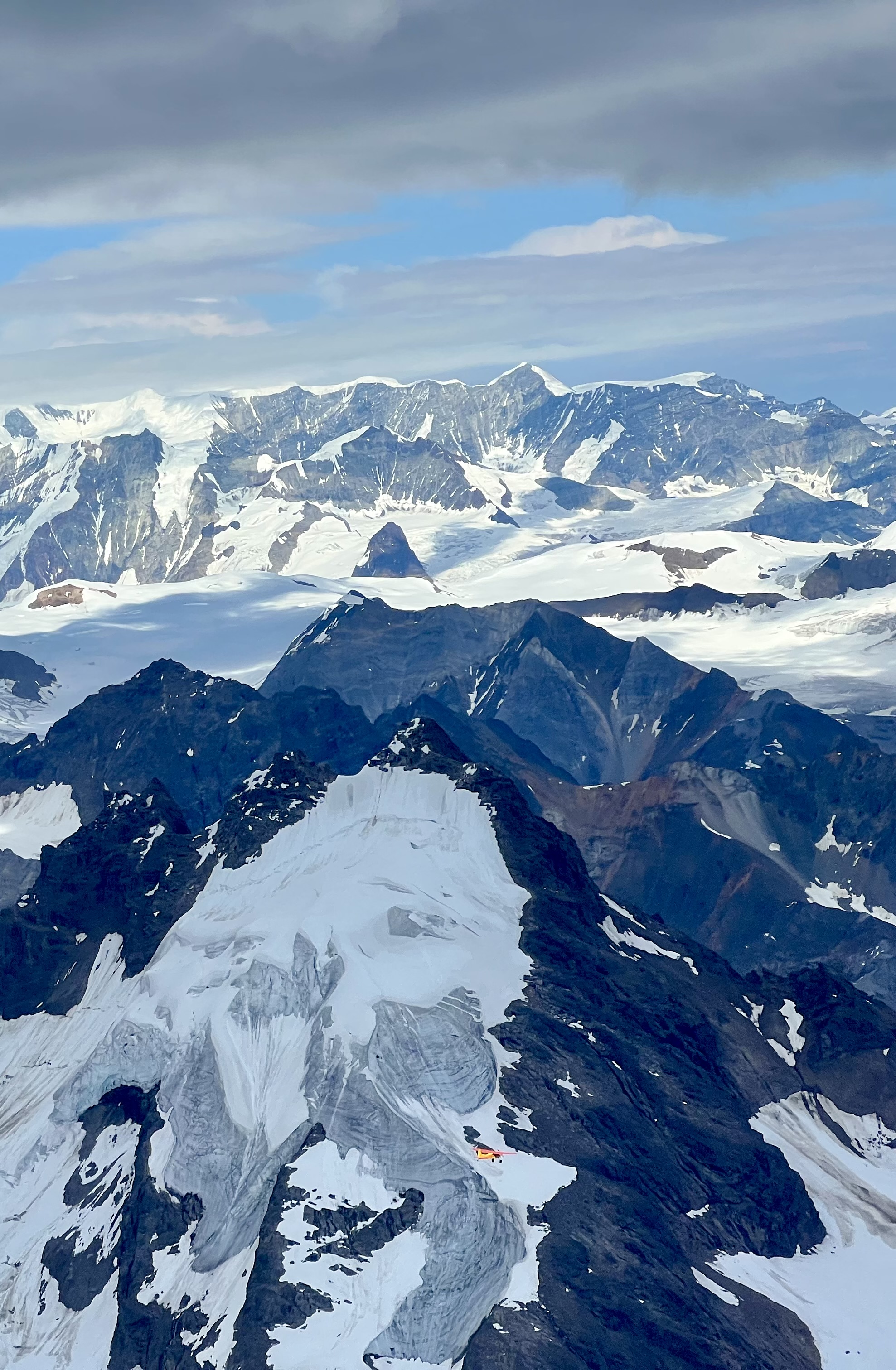
Flying back. Notice the little yellow and red dot in the lower middle. That is the Cessna 185 with John and Jed aboard.
A humbling and life affirming experience.
Wow! I am so glad you are able to see these sites and record them with photos and your comments. Thank you for sharing.